Patagonian step (Argentina)

Hi !

To give an idea of how empty can be South Patagonia on the Argentina side (the Chubut and Santa Cruz Province), we are talking of a territory roughly the size of France, with less than 1% if is population, so around 1.5 habitant per square kilometer. So in other words: a desert, with population pushed either on the mountain side (the border with Chili) or the coast side. So what is there to look at ? storms !

Rainy_Patagonia_step.jpg
Rainy Patagonia step

Enjoy (or not) and stay tuned !

Tierra del Fuego (Chile / Argentina)

Hi !

Located in the southernmost part of the world before reaching Antarctica, la Tierra del Fuego, a.k.a. The End of the World, is a land of adventure and cold wet windy weather. Here boats sink, people live in eternal winters, king crab is the best food and the nature rules ! It is also a place where the natives lived almost naked, using fires to keep warm, thus giving the name the place when the first sailors passed by and saw these fire from their boats.

As you drive from Puerto Natales (or Punta Arenas) to Tierra del Fuego, first comes the realisation of all the shipwrecks that built the myth. If most ships are now decomposing on the bottom of the oceans, seas and channels, so are forever part of the littoral. Reaching the ferry later made it clear that the strong currents are not for beginners.

Shipwreck_in_Patagonia.jpg

The southern part of the Tierra del Fuego is where the Andes ends. If in Peru the free air freezing zone (or bush line) is above 5000masl, here you only have to climb 700masl to enjoy all year round snow.

Roads_of_Tierra_del_Fuego.jpg

If I haven’t enjoyed Ushuaia as much as I should have, according to my traveling partner, the Parque Nacional Tierra del Fuego was a better surprise, the best chance to observe the vibrant green vegetation and a landscape shaped thousands of years ago by glacier.

Blooming vegetation of Parque Nacional Tierra del Fuego
Beagle Channel
Beagle Channel
Laguna Roca
Laguna Roca

Now at that point you may be noticing the grey cloudy sky and wonder if there’s any chance to see something more summer like. In short, yes, but only for a few minutes, for the wind will always end up bringing back these clouds.

Estancia_Caleta_Josefina.jpg

If I don’t have a lot of positive stuff to say about Ushuaia, I should write that my opinion is not mainstream. Many enjoy the city more than I did. However, something should be said about the king crab, and that I had the best ones there. So if this is something you are looking for, do not avoid Ushuaia.

Enjoy (or not) and stay tuned !


Patagonian roads, Argentina side (Argentina)

Hi !

I know it has been said and written a billion times, but driving in deep Argentina is not the most entertaining part of traveling there. But when you reach the south of Patagonia, driving on the Ruta 40 is an all different story: every road seems to lead you to a beautiful snow-covered mountain range.

Here you are far from everything that makes up for civilization. It can be 300km between two service station, most of them in place that would barely qualify as a settlement. Almost nothing would reveal a human presence, maybe an estancia every 100km, and most of them just because a sign says so, for the farm itself are usually away from the road.

It actually made me wonder if there was really a point of wasting that much fossil energy to discover this land of a few souls, where climate condition would make it a hell for most of us. Sure you have stunning landscape, and then, why disturbing it for the selfish goal of seen the world.

It is not so much intended to make every one of you a concerned ecologist, just a realization that I have ventured somewhere where thing should have been left as they are.

Enjoy (or not) and stay tuned !

El Calafate (Argentina)

Hi !

Though it wasn’t a long stop on our way to the End of the World, El Calafate has been the first spectacular stop since El Bolson, some 1500km north. Not much to be said though, this is just a quick capture of the evening scenery, but you can see the beautiful lake, the magnificent snow-covered mountains and the vibrant green vegetation, which by themselves summarize the beauty of this place.

A longer stop to El Calafate is planned later in January, when we’ll head back to Santiago. But I rather stay on this first impression.

Enjoy (or not) and stay tuned !

Laguna Negra (Argentina)

Hi !

Great hikes are always about the rewarding views, quiet places you can reach and some challenges along the way. For all of the above, the trail to the Refugio Laguna Negra, at the early season (late November / early December) lived up to these expectations.

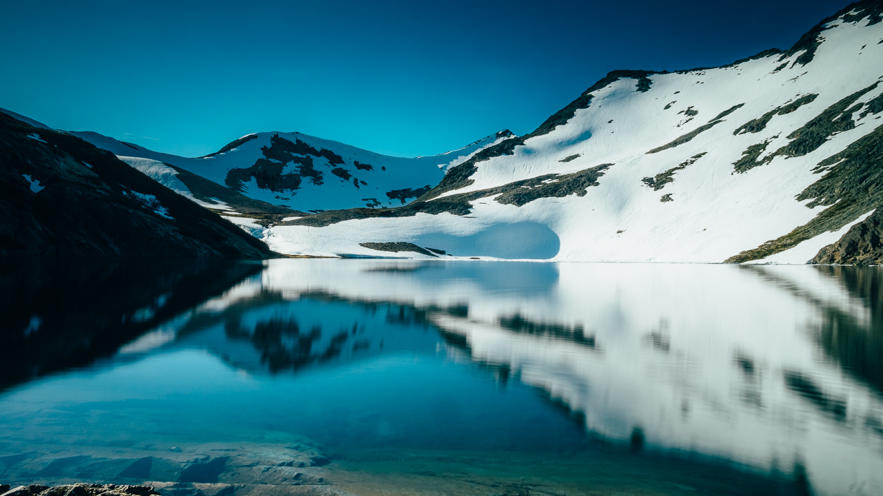
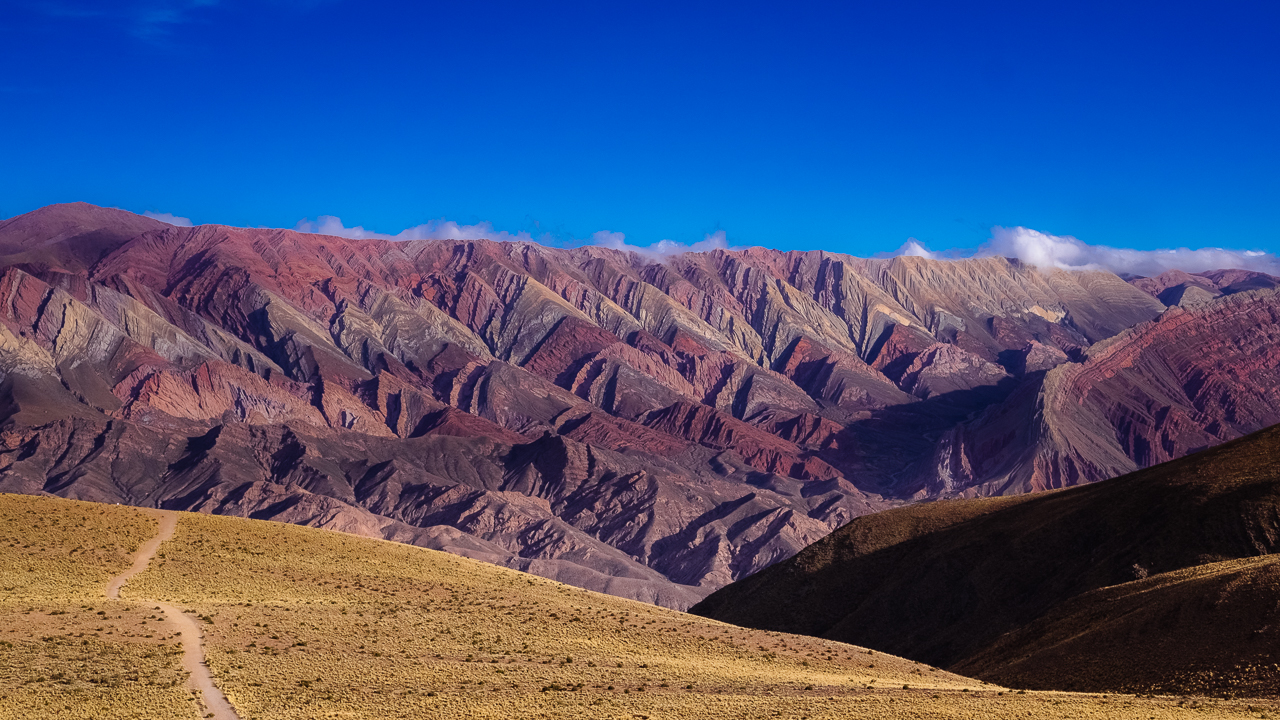
Located in the Parque Nacional de Nahuel Huapi, this is not the busiest trail and shelter around. And for that reason mostly we decided to give it a try, instead of the more common Refugio Frey trail. It starts from Colonia Suiza, a lovely former Roman Swiss settlement that is now a hippie village, busy twice a week on Wednesdays and Sundays (so plan the hike to finish on either of these two days). From there, a 14km trail will take you there, starting with a 9km mostly flat section along a little river and finishing with the climb to the Laguna Negra. The climb is challenging (it is a rapid change of pace), especially when the snow is around. But the reward is reaching a quiet little lake, with just a few other hikers. All in all, a very nice 2-days walk.

However here comes the lecturing part of this post: if you are planning on making the climb when the snow is around, here is what you need to ask the Club Andino in Bariloche prior to doing the walk, because they are not really clear about it. I think that we were actually lucky to not suffer from the snow situation, as we didn’t really know what was there waiting for us.

First, check the situation about the snow for the day you are climbing. Though avalanches aren’t a big risk if you are taking the trail from Colonia Suiza, you’ll have to walk through some snow section, with the risk that the snow is actually ice (very slippery).

Second, check what will be the weather overnight. A cold and windy night may turn the snow into ice and you’ll have to wait that it start melting before leaving the shelter, or take with you the equipment to safely descend.

Third, take a sleeping bag even if you don’t plan to stay overnight. The condition may change and it may be difficult to leave the shelter on the same day. The round trip is 28km, and it can easily take 4 to 5 hours to deal with the climb and the descend, in bad conditions. The shelter offer a safety net, you should take advantage of it.

These three points should not cool you down, the hike is really worth it and just take some basic planning.

Enjoy (or not) and stay tuned !

Lago Perito Moreno (Argentina)

Hi !

The Perito Moreno name can be found on many different landmark in Argentina, all  in Patagonia, one of them been the Perito Moreno Glacier, the most famous of all. The reason been that Dr. P. Moreno played an important role in setting the border between Chile and Argentina, using the Andes and its geological feature to build rules to split the land, lakes, mountains and river in two.

You will find very little reference to Dr. P. Moreno in Chile, for Chile probably did not find the rules fair, having the less habitable part of Patagonia, with the worst weather… However for most people this is the most incredible part.

Because Bariloche has a bad reputation for overlanders (cars are being robbed too often), Colonia Suiza is a nice alternative. It isn’t directly on the Lago Nahuel Huapi, but instead next to the very small (in comparison) Lago Perito Moreno. It doesn’t offer a direct view on the snow-covered mountains, but the top can be still be seen, and when the sun set, they are suddenly painted red.

Enjoy (or not) and stay tuned !

Lago Nahuel Huapi (Argentina)

Hi !

The Ruta de 7 Lagos (the Seven Lakes Road),  a.k.a. Ruta 40, is what Patagonia is all about: snow-covered mountains, surrounded by blue lakes, lushly green vegetation, yellow flower bushes and snake roads. It is one of these roads one must drive on once in his life. The big star of the seven lakes in Lago Nahuel Huapi, a huge body of blue icy cold water, surrounded by gorgeous mountains.

Though there are more of Patagonia to discover, with highlights like Torres Del Paine, Ushuaia, Perito Moreno glacier, Fitz Roy and more, the Ruta de 7 Lagos is a good introduction. It goes from San Martin de Los Andes, a truly charming village with a beautiful background to S.C. de Bariloche (in the region Rio Negro), a less charming bigger city with just an awesome view you can’t get bored looking at all day long. German and Swiss German (in general I would say Alpine) influences are all over the place, with the Argentinian touch. But you don’t really get there to enjoy the cities…

Bellow are various other pictures taken in the Neuquén region.

Mirador Inalco
Mirador Inalco, the first view we got of the Lago Nahuel Huapi
Muelle Bahia Brava
Muelle Bahai Brava, looking at the nothern arm of the Lago Nahuel Huapi toward Chile
Lago Traful
Lago Traful, a quiet little lake
Lago Correntoso
Lago Correntoso, connected to Lago Nahuel Huapi by a small river
Ruta de 7 Lagos
Ruta de 7 Lagos, a really not boring drive
S.C. de Bariloche
S.C. de Bariloche, in the next province of Rio Negro

Enjoy (or not) and stay tuned !

Salinas Grandes of Tumbaya (Argentina)

Hi !

Whenever I’m talking about the places I’ve visited, there’s always somebody to tell me that I shoud have been to this other place, better for it is ignored by the tourists. Today I’m doing this by trying to sell you that these salt flats are better that the Salar de Uyuni. Of course there’s no point trying to make the comparison, but, on the other end, it would be crime not to talk about the journey that took me there.

There are multiple ways to reach the Salar de Uyuni from Argentina, by either going to Tupiza in Bolivia or to San Pedro de Atacama in Chile. We picked the latest. It took us through an amazing journey from Salta (Argentina) to San Pedro (Chile), crossing the border at the Paso de Jama at some 4200masl. At first, the road took us to some high jungle, until we reached the Provincia de Jujuy. From there the rocky Andean landscape replaced the lush green vegetation, offering dramatic scenery. We then drove to the high plateaux, passing salt flats after salt falts, until we were between huge volcanoes (some reaching almost 6000masl), driving at some 4800masl. Then, the descend to San Pedro (at some 2400masl) started, but instead of the usual snake-like mountain road, the 2400m descend was nearly straight, with a change of altitude so fast I started to feel like one of my eye would pop out of my head. But it did not, just my imagination I guess.

Why these salt flats ? The road simply pass through them, which is actually unique, and convenient. Oh, and you are not surrounded by thousand of tourists, so way better 🙂

To finish, here’s a view of the sunrise…

Dramatic_sunrise_over_the_Salinas_Grandes_de_Tumbaya.jpg

Enjoy (or not) and stay tuned !

La Hornocal, or Cerro de 14 Colores (Argentina)

Hi !

The Andes offer quite a lot of features, with the rainbow mountains probably been one of the most photo friendly one. Here above is La Hornocal, or Cerro de 14 Colores (Mountain of 14 colours) which can be reached quite easily by car in Argentina and are best enjoyed around the sunset, from a Mirador at about 4200masl (provided you can bear the high altitude).

There are many other examples of these rainbow mountains, all formed though billions of years of tectonic movements and volcanic eruptions. Another testiment of nature true power, and also of the general randomness of things, as how many chances was there that these colours would mix so well.

Enjoy (or not) and stay tuned !

La Boca, Buenos Aires (Argentina)

Hi !

Buenos Aires is a city I always wanted to visit. From the best barbecued meat to the sophisticated tango, with a so-so economy and the promise of finding a vibrant popular art scene, I thought it would look like what Paris must have been before the gentrification happened. So what better to begin with than La Boca, probably the most colorful, yet one of poorest part of Buenos Aires, with strong historic importance for been one of the oldest part of the city and one that bear most of the scars of the city economic development.

It was the first port of the city and home of the largest immigrant community. It was the birth place of the tango (as a music and a dance). But the port eventually closed when a bigger and more modern one was built somewhere else, so then the neighborhood became more industrial, which took a turn for the worst as economic crisis hit Argentina. It was only when Buenos Aires artist Benito Quinquela Martin invested his money to finance some essential public services (hospital, school, …) that the neighborhood came back to life, painted with vibrant colours, inspired by the colorful art of Benito.

I like this picture of the port for they even painted the wharf, something usually left undescorated. The colors reflection on the water changed something usually grim to a pleasant view I would love to look at from my apartment.

Enjoy (or not) and stay tuned !