La Hornocal, or Cerro de 14 Colores (Argentina)

Hi !

The Andes offer quite a lot of features, with the rainbow mountains probably been one of the most photo friendly one. Here above is La Hornocal, or Cerro de 14 Colores (Mountain of 14 colours) which can be reached quite easily by car in Argentina and are best enjoyed around the sunset, from a Mirador at about 4200masl (provided you can bear the high altitude).

There are many other examples of these rainbow mountains, all formed though billions of years of tectonic movements and volcanic eruptions. Another testiment of nature true power, and also of the general randomness of things, as how many chances was there that these colours would mix so well.

Enjoy (or not) and stay tuned !

La Boca, Buenos Aires (Argentina)

Hi !

Buenos Aires is a city I always wanted to visit. From the best barbecued meat to the sophisticated tango, with a so-so economy and the promise of finding a vibrant popular art scene, I thought it would look like what Paris must have been before the gentrification happened. So what better to begin with than La Boca, probably the most colorful, yet one of poorest part of Buenos Aires, with strong historic importance for been one of the oldest part of the city and one that bear most of the scars of the city economic development.

It was the first port of the city and home of the largest immigrant community. It was the birth place of the tango (as a music and a dance). But the port eventually closed when a bigger and more modern one was built somewhere else, so then the neighborhood became more industrial, which took a turn for the worst as economic crisis hit Argentina. It was only when Buenos Aires artist Benito Quinquela Martin invested his money to finance some essential public services (hospital, school, …) that the neighborhood came back to life, painted with vibrant colours, inspired by the colorful art of Benito.

I like this picture of the port for they even painted the wharf, something usually left undescorated. The colors reflection on the water changed something usually grim to a pleasant view I would love to look at from my apartment.

Enjoy (or not) and stay tuned !


Inca Trail day 4, Intipata to Machu Picchu (Peru)

Hi !

Final day of this epic journey to the world’s 7th wonder, the Machu Picchu, it is also the most relaxed one. Only about 6 km to walk, mostly flat (or Andean flat, which means a bit up or a bit down).

Hiram Bingham discovered the Machu Picchu before he found the trail(s) leading to it. After cleaning up the Machu Picchu, he followed a trail and found the Sun Gate, and kept following that trail a uncovered the Inca Trail as we know it today. Then the consensus was that there was only one path to Machu Picchu, though by now 7 more have been found, going in various directions.

Arriving at the Sun Gate is a magical thing. First because there’s a horde of regular tourists who came by the bus station, and they only can have this view by hiking up the gate. Second because the view is just insane, though here apparently we were exceptionally lucky to have another crystal clear blue sky.

Of course, when you continue from the gate to the Machu Picchu, the magic goes away for you realise you are now one of the 3000 other tourists there. The feeling is weird as having done the walk to get to enjoy it, I sort of felt more entitled than the rest of been there… however the only advantage I had was that I could just scream that I haven’t shower for four days to get some space when the crowed thickened.

This journey was by far the best trekking I’ve done in my life… Sure this is not a private and true nature experience, but walking through this incredible landscape, on a road build some 600 years ago, passing through ruins and feeling the glorious past of the Incas is just plain awesome.

Enjoy (or not) and stay tuned !


Inca Trail day 3, Pacaymayo to Intipata (Peru)

Hi !

The third day is synonym of high jungle (and rain forest), which is basically jungle in the mountain, a concept that is mostly possible for Peru is a tropical country. It also means a lot more Inca ruins, all hidden in the lush green vegetation of this high jungle, so it has an Indiana   Jones feeling that I must admit, made it the best day on this trail.

But before you get to enjoy it, there’s the usual climb of these steep stair to begin with, in order to deal with the Runkuraqay pass (3900masl). We were all sort of scared, for the previous day left us with sore bodies, but it turned out to be rather easy climb, with terrific view on a beautiful ruin. Our guide promised us that it would be the last difficulty for the trip.

Once the pass was dealt with, the day lived up to our expectation. Ruins after ruins, gringo killer stairs after gringo killer stairs, tunnels carved in huge granite rocks, gorgeous views, and the green vegetation only missing birds singing and monkeys screaming, the journey to Machu Picchu became the adventure we were looking for, full of stories on how Hiram Bingham discovered all this forgotten heritage.

Cherry on the cake, as we were in a rain forest, it is rare to have a dry day there… we were the lucky ones, it was such a great weather to hike: crystal clear blue sky and comfortable temperatures !

Now I could have show you all of that, instead, but it turns out I kinda suck at shooting ruins, so instead I’ll leave you with the busy activity on one of the resting stops, where most groups (but not us) usually have lunch on that day.

Would I do the Inca Trail again ? For that day I’m tempting to say “yes, yes and yes !”…

Enjoy (or not) and stay tuned !

Inca Trail day 2, Wayllabamba to Pacaymayo (Peru)

Hi !

Oh that second day ! No ruins, nothing to learn about the Inca except that the stairs they built are steep, and there are so many of them to climb !! 1200m elevation gain to reach the Warmiwañuscca (Dead Woman) pass at 4200masl, with the joy of fighting against the thin air !!!

Surprisingly, considering the night camping and my previous experience at high altitude, we made it rather easily up there. It takes usually 5 hours to climb up and 2 hours to climb down to the next camp, and we needed 4 hours for the uphill section (including the breaks) and 1h15 for the downhill section. The weather was spectacularly good, so we where able to enjoy 30 minutes of view, until another reality hit us: we need food (we purposely decided not to have a lunch break half way through the climb to not deal with digestion during the steepest sections) !

As you can imagine, the obvious reward for all this effort is the view. On one side (not the picture above), there’s the view on the Wayanay glacier; on the other side (the above picture), the view on a valley and the what will be tomorrow challenge: the Runkuraqay pass (at 3900masl). This section of the Inca Trail is about the spiritual journey, as the mountain are sacred for the Incas, and while I haven’t found my religion, I would definitively agree that there’s something majestic about these mountains.

I cannot leave this post without a picture of the Wayanay Glacier…

Inca Trail day 2 (Wayanay Glacier)

Enjoy (or not) and stay tuned !


Inca Trail day 1, km 82 to Wayllabamba (Peru)

Hi !

This is the first of the 4 articles about the highlight of my first time in the Peru: the Inca Trail. Starting from km 82 (at the train station close to Ollantaytambo), the first day is all about climbing from a low 2600masl to 3000masl and acclimate for the next day.

So a gentle day in essence, good to stretch the legs and enjoy some Inca ruins and a rather dry weather. It is also a great opportunity to take a look at the Salcantay glacier, though frequently covered with clouds (just like on this picture). There are a few ruins along the way, some a bit far and some you’ll pass right through. The camping site of that night was incredibly well located, with a beautiful view on the Wayanay glacier (in front of us) and the Veronica glacier (on the left side). There was also a view on the daunting Warmiwañuscca pass, also know as the Dead Woman pass…

When I have cleaned the GPS trace properly, I’ll add the detail about the journey to this post. Until so, I’ll leave you with this picture taken at the very beginning of the day.

Enjoy (or not) and stay tuned.

Moray (Peru)

Hi !

If for most people Moray is all about these round terraces the Incas built to farm experimental crops of corn and potato, I was a lot more interested by the view of the glacier on the other side.

The Inca site itself is really nice, though probably not that high in the list of thing to see, for it is just terrace and a short 30 minutes of explanation. The round terraces (or so they look) are impressive, but a lot is left free to imagine, for there are few hard evidence (and next to no documentation) of what this site was really about.

Enjoy (or not) and stay tuned !

Lomo saltado (Peru)

Hi !

As I’m about to leave the gastronomic hotspot of South America, I think I should share the recipe of the lomo saltado, a Peruvian beef stir-fry. Ingredient, cooking and taste wise, you are not going for a lot of trouble, except of course for vegans, as animals will be armed in the making of this fine dish the rest of us should enjoy very easily.

Ingredients (for two):

  • 300gr of beef, the filet, cut in 2x2x1cm dice
  • 2 plum tomatoes, the core, liquid and seed removed, cut in 1cm wide strips
  • 1 large red onion, cut grossly in 8 half quarters (remove the center part)
  • Soy sauce
  • Red wine vinegar or pisco
  • Cilantro
  • 2 green onion (the light green part)
  • Sal and pepper
  • 2 potatoes (for the French fries)
  • Rice

The recipe is actually requiring three parallel operation: cooking the rice, frying the French fries and cooking the beef stir-fry. As the two first one are a no-brainer, I’ll focus on the last one. Maybe just a comment on the fries, which should be large, and preferably with the skin if the potatoes allow it.

So, let’s go with cooking the lomo saltado:

  1. Add salt and pepper on the beef.
  2. Warm up the wok on high heat, add the vegetal oil (from the side).
  3. When the oil is ready, add the beef and stir-fry to your liking.
  4. When the beef is cooked, reserve it. Then add the red onion and stir-fry.
  5. When the onion start to get translucent, add the tomatoes and stir-fry.
  6. Before the tomatoes get to soft, add the pisco (or red wine vinegar) and the soy sauce and stir, to get all the juices off the wok. Reduce to medium eat and add back the beef.
  7. When the sauce is a getting thick, add the cilantro and the green onion, stir a little bit more and serve with the rice and the french fries.

If you are familiar with any asian stir-fry, then this is about the same process. The key is to keep the vegetable firm. For the presentation, use a glass to shape the rice in a dome like form. I like to serve the beef over the French fries, as they’ll just absorb some of the sauce… yummy !!!

Enjoy (or not) and stay tuned !

Inca Trail through the Sacred Valley (Peru)

Hi !

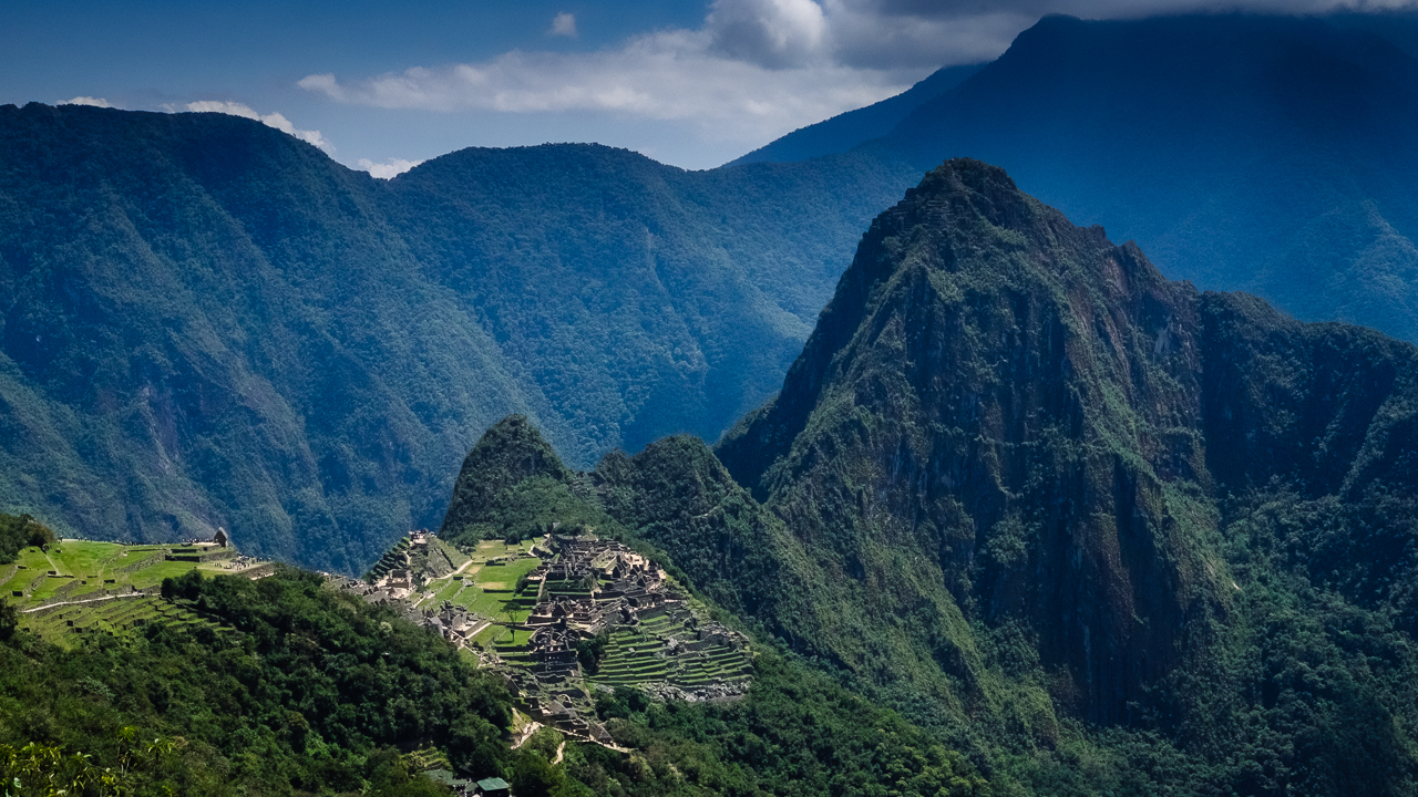
Well, this picture is not really showing much about the Inca Trail itself, but it sort of lay the expectations for what will be this incredible journey through Peru most sacred area. The Incas, aware that the spanish will make an attempt at conquering this part of Peru, decided to remove the trace of the road leading to Machu Picchu (which was sort of paved), successfully hiding the most sacred of all site. It is only several centuries later, in the early 1900, that Hiram Bingham discovered what would become the Inca Trail, subsequently leading him to the Machu Picchu. To be fair, it is likely that others knew about the site, but he was the one discovering it for us.

Therefore, this site has the particularity of having been left alone for centuries (as it was forbidden to non noble Incas to go there, it really got forgotten). When I’ll see a running fountain, I should pay my respect to the engineer who built it to last un-maintained for that long !

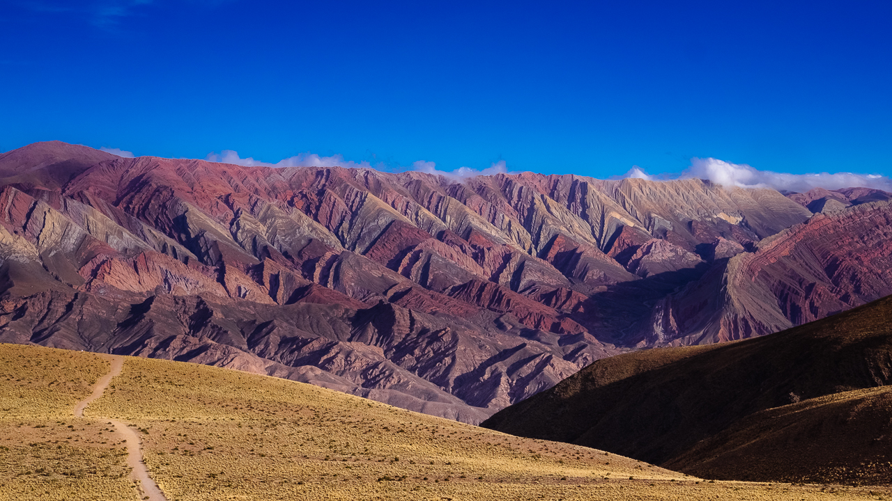
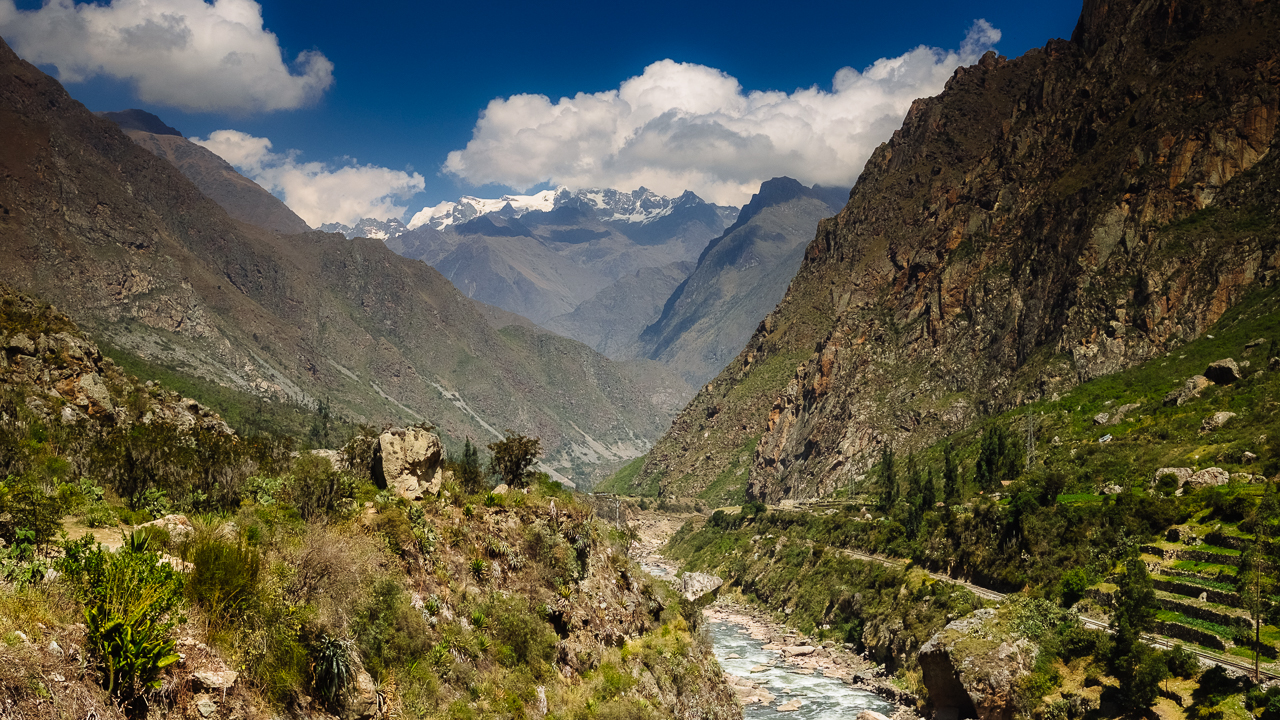
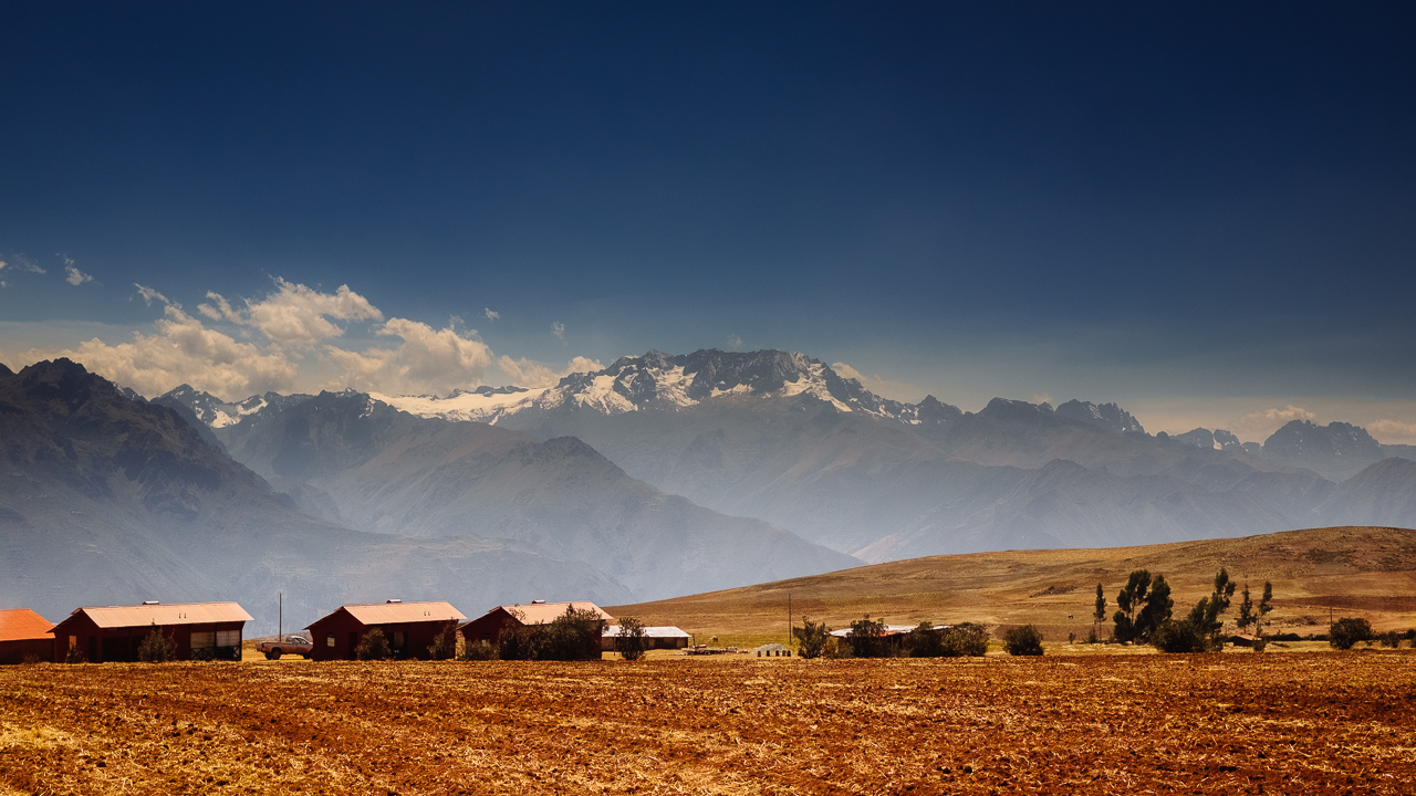
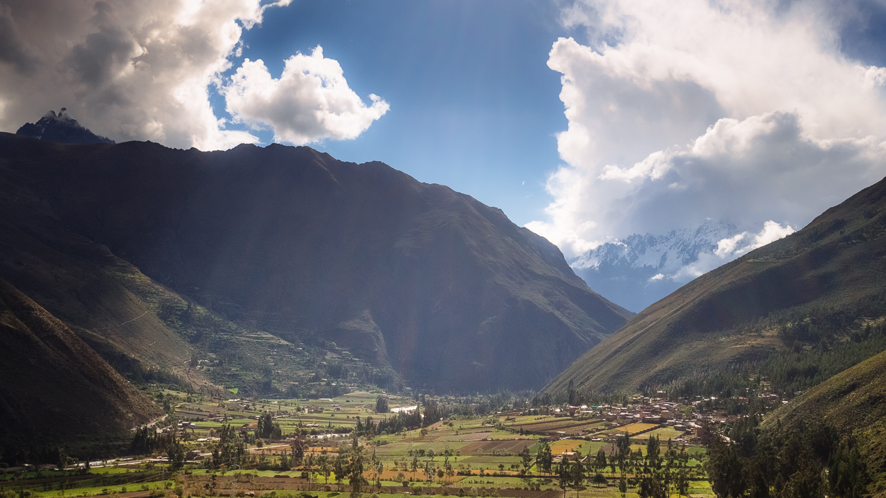
But before talking about the coming adventure, I need to give you my impression on the Sacred Valley. Though I learnt a little bit about the Inka, it is mostly ruins. And before you get the chance to visit them, there’s the mandatory passage through the various souvenir stores, all showing handcrafted stuff that could not look any less handcrafted. So much potential waisted in trying to rip the tourist. The ruins themselves are sort of repetitive, and really what makes it so special is probably the surrounding landscape.

Back to the main story !

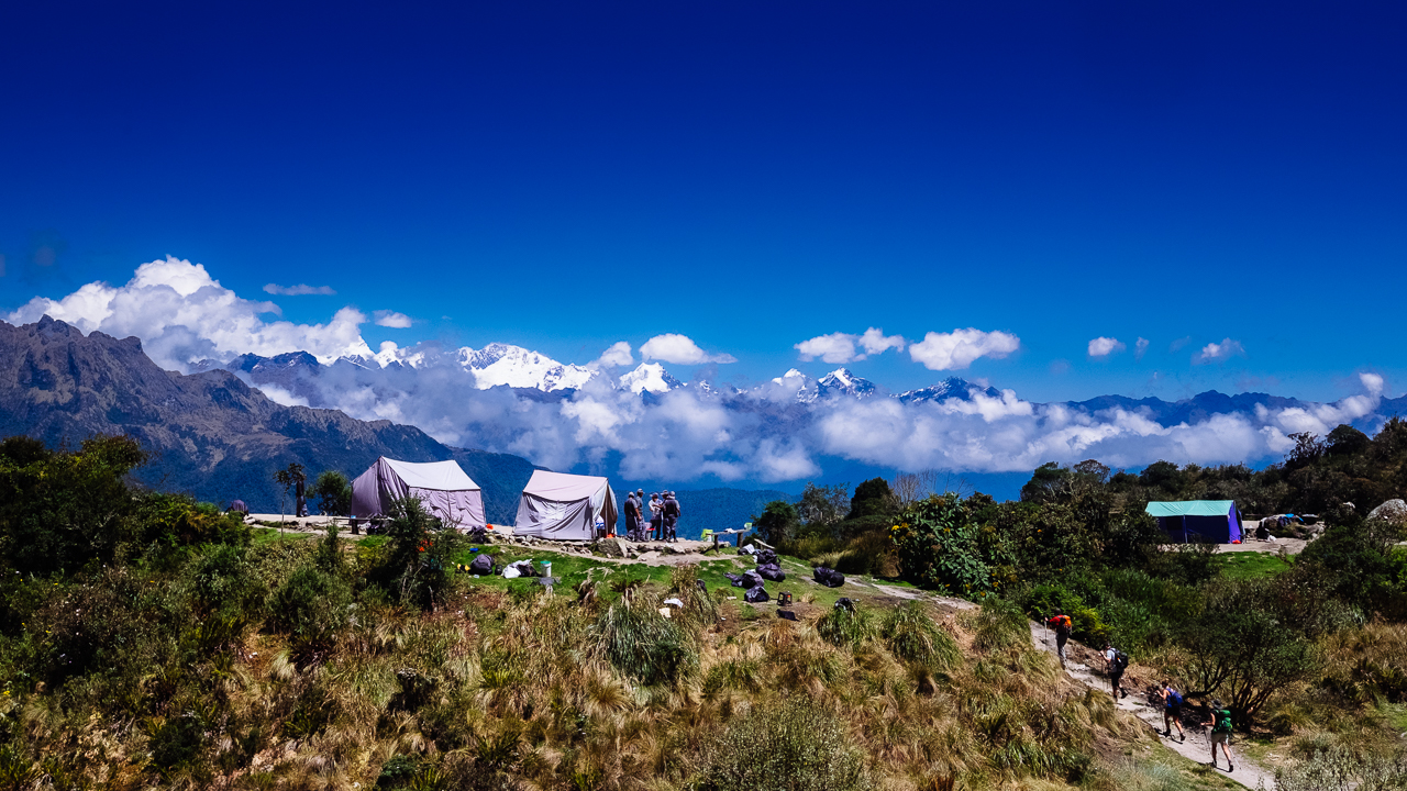
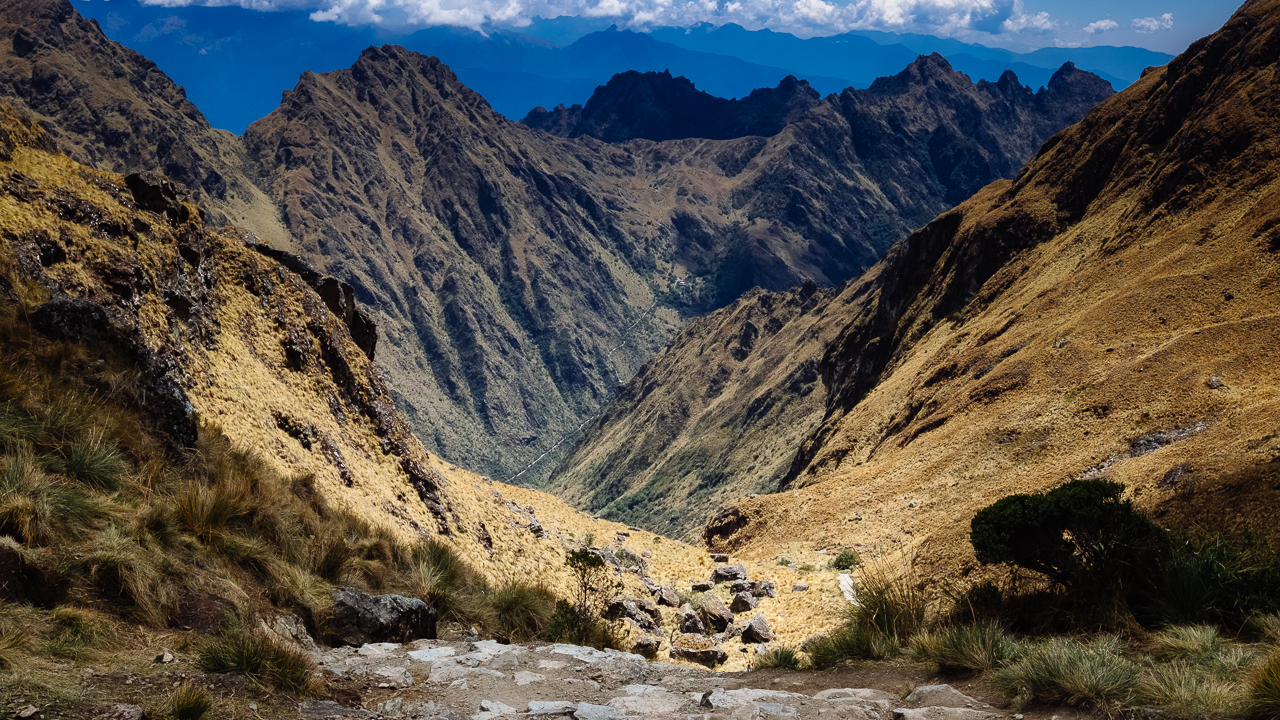
So seven days from now I’ll be putting my foot on the Inca Trail, following an old road laid by the Incas to take us from km 82 (Piscacucho) to the Machu Picchu, some 48km away. It will require us to pass a 4200masl pass (known as the Dead Women Pass), and climbing down some 2000 stairs. As I’m not in my prime years anymore, we took the 5 days options, which would mean a lot of time up there taking photos and watching endless flows of clouds passing the giants surrounding us. There’ll be also porters and cookers, so really it just about as adventurous as trying to score a decent meal in Paris. The barely freezing temperature at nights will just make any visit to the bathroom very well calculated.

Day 1: We’ll start at some 2400masl and walk some 10km to the first campsite, Hatuncacha, at some 2900masl.

Day 2: We’ll walk some 16.5km, pass the Warmiwañusca (Dead Women Pass) at 4215masl and finish at the second campsite, Pacaymayo, at some 3630masl

Day 3: We’ll walk some 11km, pass the Runkuracay (second pass) at 3900masl and finish at the third campsite, Phuyupatamarka, at some 3640masl.

Day 4: We’ll walk some 11km, going down to our third campsite, Puente Ruinas at some 2030masl.

Day 5: No walking, just catching the bus to be among the first to the Macchu Picchu.

There will be plethora of ruins and curiosity along the way. I’m gonna say the Condors will be looking at me like some potential diner, for I’m absolutely not fit, but if I can give a little something back to nature…

Enjoy (or not) and stay tuned !

Active volcano (Peru)

Hi !

Peru is one of this country that offers a huge variety of climate and landscape, from desert to tropical jungle, mountains and plateau higher that the highest peak in Europe. Driving (or been driven) in this environment is really an experience by itself, especially when you arrive at some 4900masl and see 8 volcanoes around you.

One of them was showing some activity, not really sure if this is just a production of steam, toxic gazes or the premises of a violent eruption. The story remains to be written on that.

Volcanoes and peaks all bear a huge importance for the Incas and pre-Incas, believing they were spirit protecting them. Yet most city stories usually are marked by the violence of the earthquakes and eruptions, which (if you have to look at the bright side) were reasons for them to improve their building technic and selection of location to establish new settlement.

Enjoy (or not) and stay tuned !

1 2 3 4 5 10